About All Tours Wildlife ToursHalf Day ToursAnd Yellowstone ToursFrom Jackson HoleSafari ToursPrivate ToursSelf-Guided Audio Tours Directions Hours & Fees
Find Tours 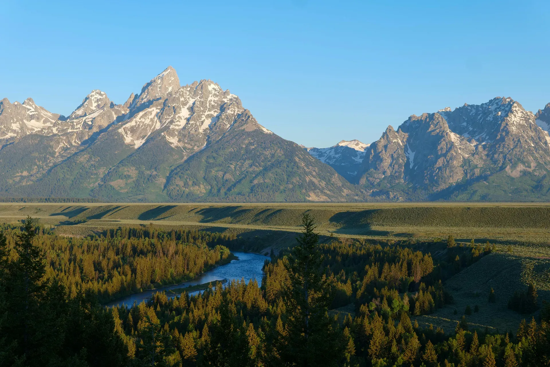
Grand Teton National Park encompasses 310,000 acres of glacially scoured mountains and alpine lakes in northwestern Wyoming. The 13,770-foot summit of Grand Teton rises 7,000 feet directly from the Jackson Hole valley floor without foothills.
Glaciated peaks dominate the northwestern Wyoming skyline at Grand Teton National Park. The 310,000-acre reserve protects the northern Teton Range and the Jackson Hole valley, sitting just 10 miles south of Yellowstone National Park. Mountains here lack foothills entirely. They shoot 7,000 feet straight up from the sagebrush flats to a maximum elevation of 13,770 feet at the Grand Teton summit. The Snake River cuts a braided path through this valley, feeding deep glacial bodies of water like Jackson Lake and Jenny Lake. The ecosystem spans nearly 18 million acres when combined with surrounding protected lands, forming a massive intact mid-latitude temperate environment.
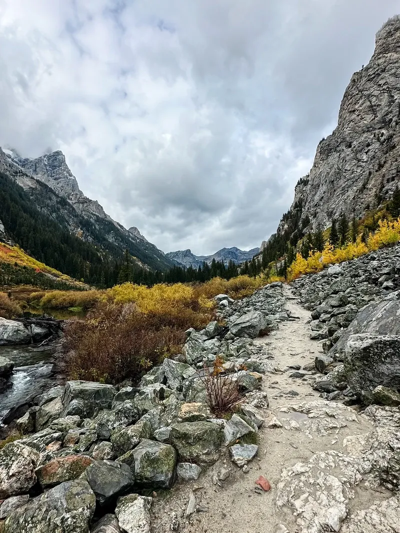
Visitors navigate a landscape defined by sharp elevation changes and ancient geology. A 42-mile scenic loop road connects the major trailheads, boat launches, and historic homesteads. Summer brings hikers to the 235-mile trail network, where routes range from the flat, paved multi-use path to the grueling 7-mile loop around Jenny Lake. Winter shuts down most facilities and buries the roads in snow from November through April. Bears, elk, and moose dictate the pace of travel year-round. Traffic stops completely when a grizzly crosses Highway 89. Motorists must obey strict speed limits, which drop to 45 mph at night to reduce severe wildlife collisions.
Access requires planning around extreme weather and strict park rules. The gates stay open 24 hours a day, year-round, but services operate on a tight May-to-September window. Electronic payments are mandatory. The $35 private vehicle pass lasts seven days and grants access to all trailheads and pull-outs. Facilities like the Craig Thomas Discovery Center and Colter Bay Visitor Center provide wheelchair-accessible restrooms and flat, paved routes. Arrive at the Jenny Lake Visitor Center before 10:00 AM in July, or you will park a half-mile away on the shoulder of Teton Park Road.
Human footprints in Jackson Hole date back 11,000 years. Nomadic Paleo-Indians tracked game through the valley during the brief summer months, leaving behind stone tools and roasting pits. The Mountain Shoshone eventually established a year-round presence. They survived the harsh winters by utilizing the region's geothermal features and hunting the abundant elk herds. European fur trappers arrived in the early 19th century, seeking beaver pelts for the European hat market. French-speaking trappers named the prominent peaks "Les Trois Tetons" around 1810. The fur trade collapsed by the 1840s, leaving the valley largely empty of Europeans for another forty years.
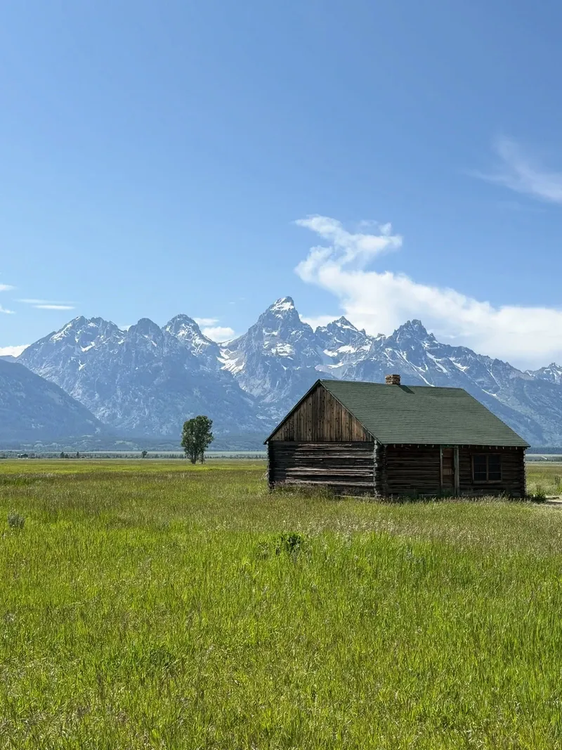
Homesteaders followed in the 1880s, claiming 160-acre plots under the Homestead Act. They built structures like the Moulton Barns along Antelope Flats, attempting dry farming in the rocky, high-altitude soil. Many failed. The 6,800-foot elevation resulted in short growing seasons and frequent summer frosts. The harsh climate forced early settlers to transition from farming to cattle ranching. By the 1920s, agricultural struggles led many ranchers to convert their properties into dude ranches, hosting wealthy eastern tourists who wanted to experience cowboy life. The JY Ranch and the White Grass Ranch became early pioneers of this new tourism economy.
Congress established the original Grand Teton National Park in 1929 under President Calvin Coolidge. This initial designation only protected the major peaks and a narrow strip of lakes at their base. The valley floor remained in private hands, dotted with gas stations, billboards, and dance halls. John D. Rockefeller, Jr. recognized the threat of commercial development during a 1926 visit. He secretly purchased 35,000 acres of Jackson Hole land through a shell company called the Snake River Land Company, intending to donate it to the federal government. Local ranchers and politicians fiercely opposed the expansion when the secret broke, fearing lost tax revenue and restricted grazing rights. The conflict stalled the land transfer for over a decade.
President Franklin D. Roosevelt bypassed Congress in 1943, declaring the remaining valley land as the Jackson Hole National Monument. The move sparked outrage. Wyoming politicians attempted to abolish the monument, but Roosevelt vetoed their bill. Armed standoffs nearly occurred between local ranchers and federal officials. Compromise finally arrived in 1950. Congress merged the 1929 park, the 1943 monument, and Rockefeller's donated lands into the modern 310,000-acre Grand Teton National Park. The legislation included provisions to reimburse Teton County for lost taxes and allowed existing grazing rights to continue. Today, visitors looking to explore the historic Mormon Row settlement should bring a wide-angle lens to capture the 1890s barns against the jagged mountain backdrop.
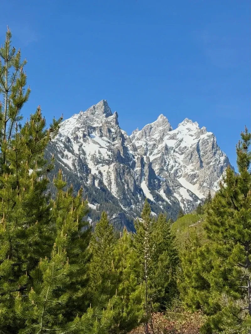
The Teton Range is the youngest mountain chain in the Rocky Mountains, yet it contains some of the oldest rocks in North America. Metamorphic gneiss and schist on the flanks of Mount Moran date back 2.68 billion years. These ancient rocks were uplifted along a 40-mile normal fault line starting just 10 million years ago. Earthquakes caused the western block to hinge upward while the eastern block dropped, creating the Jackson Hole valley. This fault block action explains the complete absence of foothills. The mountains rise 7,000 feet straight out of the sagebrush, peaking at 13,770 feet. The fault remains active today, capable of producing magnitude 7.5 earthquakes.
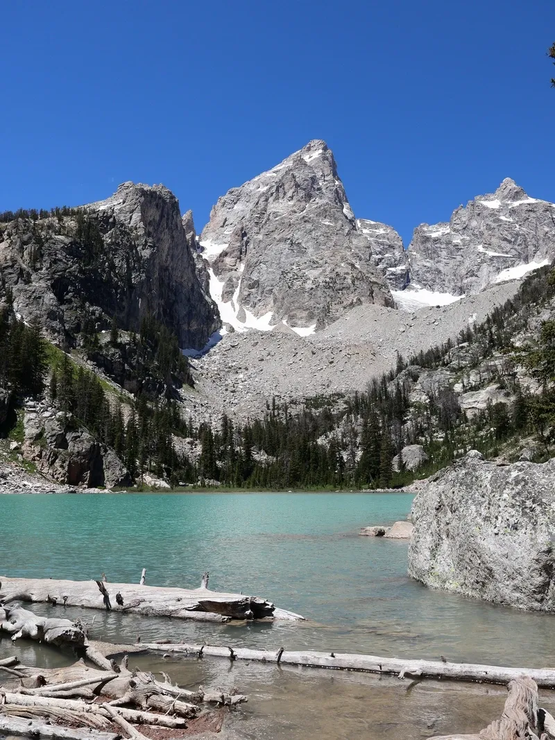
Massive glaciers carved the jagged profile visible today. Ice rivers up to 3,000 feet thick scoured the canyons and polished the granite peaks during the Pleistocene Epoch. As the ice retreated 15,000 years ago, it left behind terminal moraines—massive piles of rock and debris that now act as natural dams. These moraines hold back the waters of Jenny, Bradley, Taggart, and Phelps lakes at the base of the range. Jackson Lake, the park's largest body of water, occupies a deep glacial trough. A concrete dam constructed across the Snake River in 1911, and later rebuilt, now regulates its water level for Idaho farmers.
The Snake River winds through the valley floor, creating a dynamic riparian zone. The water flows fast and cold, hiding submerged trees known as strainers beneath the surface. These fallen trees trap boats and swimmers against the current, posing severe drowning risks. Calm mornings on the river frequently turn into windy, dangerous afternoons with unpredictable currents. Boaters must carry patch kits and wear life jackets at all times. Check the weekly updated river flow rates by calling the park's dispatch line before launching any watercraft.
Grand Teton represents the rugged ideal of the American West. The jagged skyline has served as the backdrop for countless Western films, including the 1953 classic "Shane." Landscape photographers flocked to the valley throughout the 20th century. Ansel Adams captured the Snake River winding beneath the peaks in 1942, cementing the park's visual legacy in the national consciousness. Today, Schwabacher Landing offers photographers the exact mirror reflection of the mountains that has drawn artists to the valley for a century. The calm, slow-moving waters here provide perfect conditions for sunrise photography when the first light hits the Grand Teton summit.
The park preserves the physical remnants of early pioneer life. Mormon Row stands as a stark reminder of the grueling conditions faced by 1890s homesteaders. The weathered wood of the T.A. Moulton Barn, built over 30 years, illustrates the sheer determination required to survive winters in Jackson Hole where temperatures drop to 40 below zero. Menors Ferry Historic District showcases a replica of the original 1892 cable ferry that provided the only safe crossing of the Snake River for miles. These structures anchor the cultural identity of the region, linking modern visitors to the harsh realities of western expansion.
Indigenous ties to the land remain active. The Greater Yellowstone Ecosystem holds historical importance for tribes including the Shoshone, Bannock, Blackfeet, and Crow. They utilized the valley's resources for millennia, sourcing obsidian for tools and hunting game before European contact. Federal regulations now strictly prohibit the collection of any natural or historic items, including archaeological artifacts, wildflowers, and elk antlers. Visitors must leave all objects exactly where they find them to preserve this 11,000-year human record.
The Jackson Hole Airport is the only commercial airport located entirely within a US National Park.
The park contains metamorphic rocks dating back 2.68 billion years, making them some of the oldest in North America.
Grizzly bears roam throughout the park and can charge at speeds up to 35 miles per hour.
The Teton Range is actively growing, rising along a fault line that produces periodic earthquakes.
John D. Rockefeller, Jr. secretly purchased 35,000 acres of land through a shell company to donate to the federal government.
The park operates entirely cashless, requiring electronic payments for all entrance fees and backcountry permits.
The adjoining National Elk Refuge provides critical winter habitat for thousands of migrating elk.
A standard 7-day pass costs $35.00 for a private vehicle, $30.00 for a motorcycle, and $20.00 per person entering on foot or bicycle. The park is entirely cashless and only accepts electronic payments.
No, vehicle reservations or timed-entry permits are not required to enter Grand Teton. All lodging and campgrounds within the park must be reserved in advance, and they often fill up months ahead.
Pets are permitted but must be kept on a leash of 6 feet or less and remain within 30 feet of roadways. They are strictly prohibited on hiking trails, the multi-use pathway, and inside visitor centers.
The highest peak is Grand Teton, standing at an elevation of 13,770 feet above sea level. It towers 7,000 feet abruptly above the flat valley floor of Jackson Hole.
The oldest metamorphic rocks found in the park, including gneiss and schist, date back 2.68 billion years. These ancient formations are visible on the flanks of Mount Moran.
No, launching, landing, or operating unmanned aircraft of any kind is strictly prohibited within the park boundaries. This federal regulation protects wildlife and preserves the natural quiet of the environment.
Grand Teton National Park features an extensive network of hiking trails totaling more than 235 miles. These trails offer routes ranging from flat lakeside strolls to challenging climbs up high peaks.
Congress established the original park in 1929 to protect the major peaks of the Teton Range. In 1950, most of the Jackson Hole National Monument was officially incorporated into the park boundaries.
The park charges fees most of the year, but it is free to enter from November to April. Most roads, campgrounds, and facilities are closed or have reduced hours during these winter months.
Because the park is open 24 hours a day, you can drive through if the entrance station is unstaffed upon arrival. You must pay your park entrance fee online or at a visitor center permits desk later.
Browse verified tours with free cancellation and instant confirmation.
Find Tours